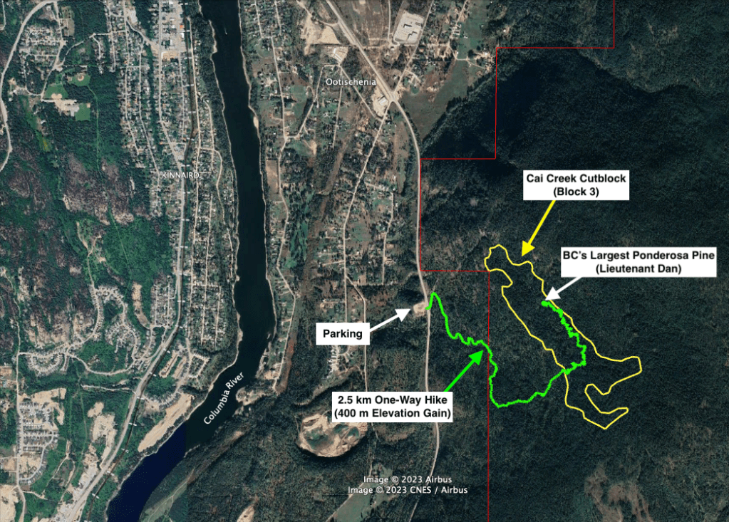
Cai Creek can be accessed off Highway 3 just outside Castlegar.
Hiking Access to Lieutenant Dan (Spring/Summer/Fall)
3 hour return | 2.5 km one way | 400 m elevation gain
- Park on the west side of the highway in a large gravel lot. Google Maps
- Cross the highway and walk up the runaway lane. On your right there will be an old ATV trail.
- Hike up the ATV trail for about 1 hour, gaining 400 m at a steady 15-20% grade.
- After about 2 km you will start to see flagging tape – you are in the BCTS cutblock.
- After 2.1 km you come to a sharp corner. You will see green flagging tape. Leave the ATV trail here enter the woods.
- Hike north for ~500 m following the green flagging tape through the forest.
- After about 20-30 minutes you will arrive at Lieutenant Dan – BC’s largest Ponderosa Pine.
Link to public KML track on Gaia:
https://www.gaiagps.com/public/QyflVneHhmH9V08QwopEHW4q/
Spring/Summer/Fall Parking Location (Avalanche Area in Winter)
https://maps.app.goo.gl/2qWd645eBtAmDfB98
Page Last Updated: January 28 2024
